README.md
In agrospace/ASAPI: 'Agro Space API' Connector Package

ASAPI: AgroSpace API R Packages 
- More than 20 satellite scientific index to be use in your
application.
- Satellite Biophysics index
- Ready to use!
OpenAPI Full documentation in
api.agrospace.cl
Installation
remotes::install_github('agrospace/ASAPI')
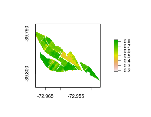
Raster Layer
Satellite information base on pixel size of your farm.
Vectorial Layer

The vectorial layer contains attributable geometries to by assigned as
paddocks names or similar information.

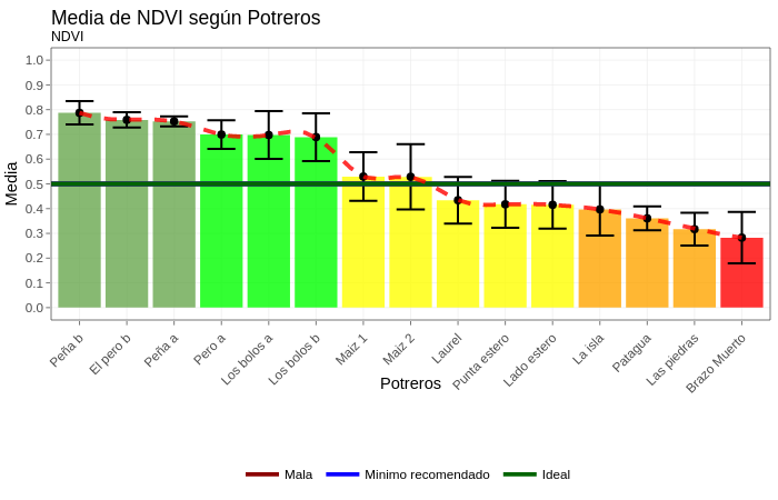
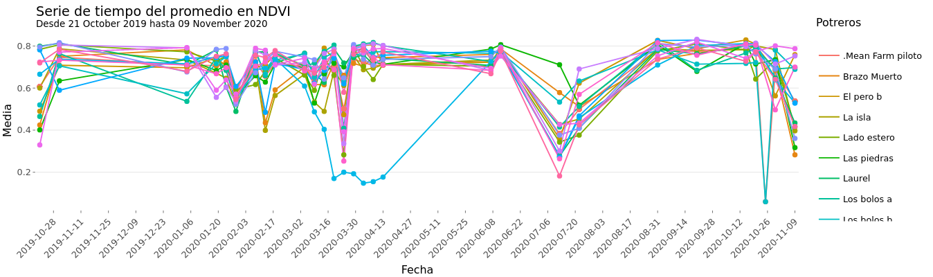
Time series
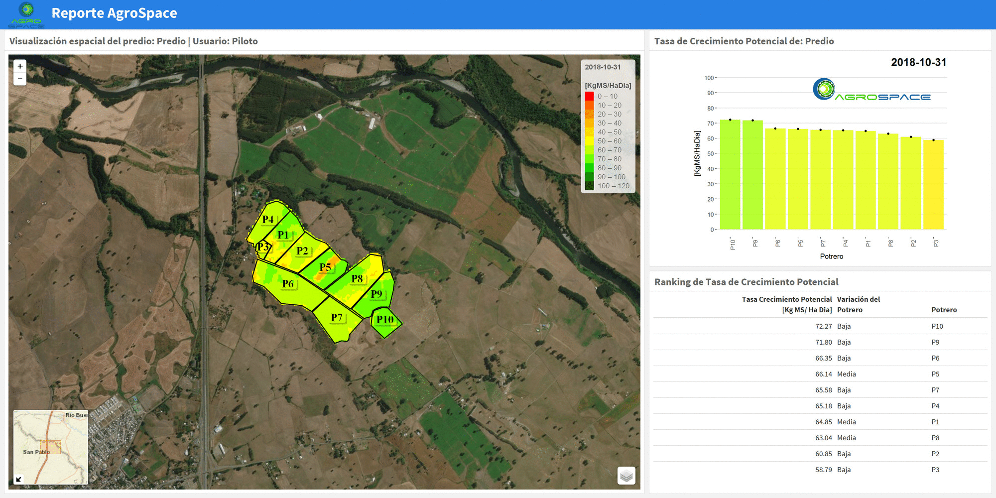
GIF and Dashboards
Code of conduct
Please note that this project is released with a Contributor Code of
Conduct. By participating in this project you
agree to abide by its terms.
AgroSpace R Packages to use api.agrospace.cl
For work over new features please work in new branches
# create new branch
git checkout -b features
git pull

# push new branch to github
git push origin features

# set tracking
git branch --set-upstream-to=origin/features features

#delete branch locally
git branch -d features

# delete branch remotely
git push origin --delete features
Additional documentation
# https://r-pkgs.org/description.html
# https://kbroman.org/github_tutorial/
agrospace/ASAPI documentation built on Nov. 26, 2021, 3:36 a.m.
R Package Documentation
Browse R Packages
We want your feedback!
Note that we can't provide technical support on individual packages. You should contact the package authors for that.
![]()
ASAPI: AgroSpace API R Packages
- More than 20 satellite scientific index to be use in your application.
- Satellite Biophysics index
- Ready to use!
OpenAPI Full documentation in api.agrospace.cl
Installation
remotes::install_github('agrospace/ASAPI')
Raster Layer
Satellite information base on pixel size of your farm.
Vectorial Layer
The vectorial layer contains attributable geometries to by assigned as paddocks names or similar information.
Time series
GIF and Dashboards
Code of conduct
Please note that this project is released with a Contributor Code of Conduct. By participating in this project you agree to abide by its terms.
AgroSpace R Packages to use api.agrospace.cl
For work over new features please work in new branches
# create new branch
git checkout -b features
git pull
# push new branch to github
git push origin features
# set tracking
git branch --set-upstream-to=origin/features features
#delete branch locally
git branch -d features
# delete branch remotely
git push origin --delete features
Additional documentation
# https://r-pkgs.org/description.html
# https://kbroman.org/github_tutorial/
R Package Documentation
Browse R Packages
We want your feedback!
Note that we can't provide technical support on individual packages. You should contact the package authors for that.
Embedding an R snippet on your website
Add the following code to your website.
For more information on customizing the embed code, read Embedding Snippets.