In bcgov/tidyhydat: Extract and Tidy Canadian 'Hydrometric' Data
layout: true
# Copyright 2019 Province of British Columbia
#
# Licensed under the Apache License, Version 2.0 (the "License");
# you may not use this file except in compliance with the License.
# You may obtain a copy of the License at
#
# http://www.apache.org/licenses/LICENSE-2.0
#
# Unless required by applicable law or agreed to in writing, software distributed under the License is distributed on an "AS IS" BASIS,
# WITHOUT WARRANTIES OR CONDITIONS OF ANY KIND, either express or implied.
# See the License for the specific language governing permissions and limitations under the License.
options(htmltools.dir.version = FALSE)
options(width = 90)
options(max_print = 5)

knitr::opts_chunk$set(
  collapse = TRUE,
  echo = FALSE,
  comment = "#>",
  fig.path = "graphics/prod/figs"
)

options(scipen = 10)
library(tidyhydat)
library(weathercan)
library(knitr)
library(tidyverse)
library(lubridate)
library(corrr)
library(sf)
library(rnaturalearth)
library(fontawesome)
bg_black <- "#272822"

theme_set(theme_void() %+replace%
            theme(legend.text = element_text(colour = "white", size = 18),
                  legend.title = element_text(colour = "white", size = 18),
                  plot.background = element_rect(fill = bg_black, color = bg_black),
                  axis.text = element_text(colour = "white", size = 16),
                  axis.title = element_text(colour = "white", size = 18),
                  axis.title.y = element_text(angle = 90, vjust = 1),
                  plot.title = element_text(colour = "white", size = 22, hjust = 0)))


scale_colour_continuous <- scale_colour_viridis_c
scale_fill_continuous <- scale_fill_viridis_c
scale_colour_discrete <- scale_colour_viridis_d
scale_fill_discrete <- scale_fill_viridis_d
Outline
.VeryLarge[
- Who am I?
- Learning Outcomes
- Review R and RStudio and rationale behind using them
- Introduce packages:
- dplyr
- tidyhydat
- weathercan
- Provide an example of using them together
- tidyhydat and weathercan development
- Where and how to get help in R
- Questions
]
Sam Albers
.pull-left[
- Data Scientist with BC government
- Environmental Scientist by training
- Been using R for 10 years
- Maintainer for tidyhydat, rsoi
- Contributor on many other packages including weathercan
- Maintainer of the Hydrology task view
]
.pull-right[

r fa(name = "twitter") @big_bad_sam
r fa(name = "github") @boshek
r fa(name = "paper-plane") sam.albers@gov.bc.ca
]
What are we hoping to learn?
.pull-left[
.VeryLarge[
- Describe visual elements of RStudio
- Define and assign data to variable
- Manage your workspaces and projects
- Call a function
- Understand the six main dplyr verbs
- Overview of tidyhydat and weathercan functions
- Describe usage of tidyhydat and weathercan
- How to ask for help in R
]
]
.pull-right[

]
class: inverse, center, middle
Common Analysis Problems
class: center, basic
Accessing Environment and Climate Change Canada Data
include_graphics("graphics/ec_data_explorer2.gif")
11 clicks!
class: basic, center
Stakeholder/Manager: "Hey, this is a really cool analysis but we need to add five stations. Can you run it again?"

--
Make it reproducible!
Questions worth asking...
.large[
- Are your methods reproducible?
- What is your analysis recipe?
- Can you share it?
]

class: inverse, left, middle
...Use R!
.pull-left[
(or more generally any programmatic code based analysis approach...)
]

.pull-left[
What is R?
.large[
- Free and open source
- Statistical programming language
- Publication quality graphics
- Much of the innovation occurs in contributed packages
- But definitely not intimidating...
]
Some example code
all_time_greats <- c(99, 66, 4, 9)
<-: assignment operatorall_time_greats: objectc: function
]
--
.pull-right[
What is RStudio?
.large[
- Provides a place to write and run code
- A means to organize projects
- Referred to as an IDE
]
--
Not guaranteed to help with this...

]
class: inverse, left, middle
R and RStudio
.pull-left[
The Problem
- Many tasks when analyzing environmental data are repetitive yet interactive
- Typically hydrologists/water professionals aren't computer scientists
- Helpful to abstract away unneeded complexity when possible
- A clean and easy to remember syntax reduces your cognitive load when doing analysis

]
--
.pull-right[
Enter dplyr
a consistent set of verbs that help you solve the most common data manipulation challenges
- Independent of the data source
- Designed for data science

]
dplyr verbs
Functions with English meanings that map directly to the action being taken when that function is called
Installation: install.packages("dplyr")
.pull-left[
- %>% a special symbol to chain operations. Read it as "then"
- select() picks variables based on their names.
- filter() picks cases based on their values.
- summarise() reduces multiple values down to a single summary.
- arrange() changes the ordering of the rows.
- mutate() adds new variables that are functions of existing variables
For a offline tutorial: http://swcarpentry.github.io/r-novice-gapminder/13-dplyr/index.html
]
.pull-right[
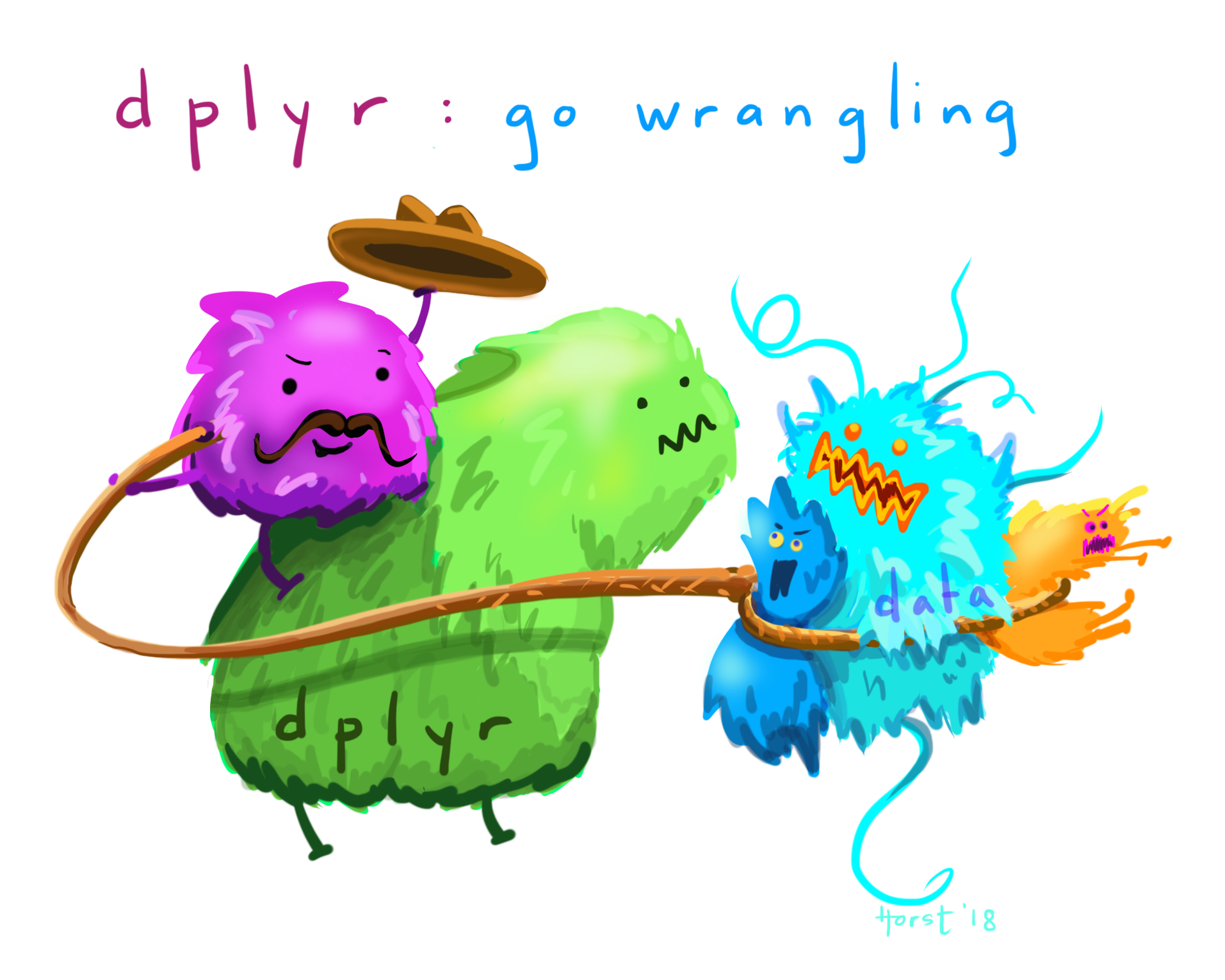
Artwork by @allison_horst
]
class: inverse, left, middle
dplyr code break
class:basic
The objective of tidyhydat is to provide a standard method of accessing ECCC hydrometric data sources (historical and real time) using a consistent and easy to use interface that employs tidy data principles within the R project.

Installation: install.packages("tidyhydat")
hydat::Water Survey of Canada Network
.pull-left[
stns <- hy_stations() %>%
  filter(HYD_STATUS == "ACTIVE")

stns_sf <- st_as_sf(stns, coords = c("LONGITUDE","LATITUDE"),
             crs = 4326,
             agr= "constant")

can <- ne_countries(country = "Canada", returnclass = "sf")

ggplot() +
  geom_sf(data = can, fill = NA) +
  geom_sf(data = stns_sf, size = 1, aes(colour = PROV_TERR_STATE_LOC)) +
  guides(colour = FALSE) +
  coord_sf(crs = 102009, datum = NA) +
  theme_void()
]
.pull-right[
r round(fs::file_size(file.path(hy_dir(), "Hydat.sqlite3"))/1E9,2) GB
r nrow(hy_stations()) stations in database
SQLite database
Self contained
]
class:basic
The objective of weathercan is to provide a standard method of accessing ECCC climate data sources using a consistent and easy to use interface that employs tidy data principles within the R project.

Installation: install.packages("weathercan")
weathercan::Climate Data
.pull-left[
stations_unique <- stations %>%
  select(prov, station_name, lat, lon) %>%
  unique()


weather_stns_sf <- stations_unique %>%
  filter(!station_name == "POINT LEPREAU") %>%
  filter(!is.na(lat), !is.na(lon)) %>%
  st_as_sf(coords = c("lon","lat"),
             crs = 4326,
             agr= "constant")

can <- ne_countries(country = "Canada", returnclass = "sf")

ggplot() +
  geom_sf(data = can, fill = NA) +
  geom_sf(data = weather_stns_sf, size = 1, aes(colour = prov)) +
  guides(colour = FALSE) +
  coord_sf(crs = 102009, datum = NA) +
  theme_void()
]
.pull-right[
r length(unique(stations$station_name)) stations
Available online
]
class: inverse, center, middle
Looking closer at tidyhydat and weathercan
class: basiclh
tidyhydat
Download the database:
download_hydat()
Access some flow data
flows_data <- hy_daily_flows(station_number = c("08MF005","09CD001","05KJ001","02KF005"))
<-: assignment operatorflows_data: objecthy_daily_flows: functionstation_number: argument
What else is available in tidyhydat?
All tables in HYDAT
.Large[
- See help(package = "tidyhydat")
- Realtime data
- Instantaneous peaks
- Daily, monthly and yearly temporal summaries
- Discharge, level, sediment, particle size
- Data ranges
- Station metadata
]
What else is available in tidyhydat?
plot(flows_data)
What else is available in tidyhydat?
search_stn_name("fraser")
class: inverse, left, middle
tidyhydat code break
weathercan
vic_gonzales <- weather_dl(station_ids = "114", interval = "day", start = "2019-01-01", end = "2019-01-31")
vic_gonzales
What else is available in weathercan?
.Large[
- See help(package = "weathercan")
- Normals
- Climate normals measurements
- Station metadata
]
class: inverse, left, middle
weathercan code break
Path of Hurricane Dorian
## Download the data
zip_path <- tempfile()

download.file("https://www.nhc.noaa.gov/gis/best_track/al052019_best_track.zip",
              destfile = zip_path)
unzip(zip_path, exdir = "data/dorian")

## Read in
dorian <- read_sf("data/dorian/AL052019_pts.shp") %>%
  st_transform(3347)
north_america = ne_countries(continent = "North America", returnclass = "sf") %>%
  st_transform(3347)
ggplot() +
  geom_sf(data = north_america, aes(fill = sovereignt), alpha = 0.3) +
  geom_sf(data = dorian, colour = "black") +
  guides(fill = FALSE) +
  theme_void()
Point where Dorian is over Canadian land
canada = ne_states(country = "Canada", returnclass = "sf") %>%
  st_transform(3347)

dorian_canada <- st_intersection(dorian, canada)


ggplot() +
  geom_sf(data = canada, aes(fill = name), alpha = 0.3) +
  geom_sf(data = dorian_canada, colour = "purple", size = 3) +
  guides(fill = FALSE) +
  theme_void()
Nova Scotia with buffer
dorian_buffer <- st_buffer(dorian_canada, dist = 7E4)

maritimes <- canada %>%
  filter(name %in% c("New Brunswick", "Nova Scotia", "Prince Edward Island"))


ggplot() +
  geom_sf(data = maritimes, aes(fill = name), alpha = 0.3) +
  geom_sf(data = dorian_canada, colour = "purple", size = 3) +
  geom_sf(data = dorian_buffer, colour = "orange", alpha = 0.5) +
  guides(fill = FALSE) +
  theme_void()
Hydrometric Stations
hydro_stations <- realtime_stations() %>%
  st_as_sf(coords = c("LONGITUDE", "LATITUDE"),
           crs = 4326,
           agr = "constant") %>%
  st_transform(3347)

climate_stations <- stations %>%
  filter(end == 2019) %>%
  filter(interval == "hour") %>%
  filter(!is.na(lon), !is.na(lat)) %>%
  st_as_sf(coords = c("lon", "lat"),
           crs = 4326,
           agr = "constant") %>%
  st_transform(3347)

hydro_dorian <- st_intersection(hydro_stations, dorian_buffer)

climate_dorian <- st_intersection(climate_stations, dorian_buffer)

ggplot() +
  geom_sf(data = maritimes, aes(fill = name), alpha = 0.3) +
  geom_sf(data = dorian_canada, colour = "purple", size = 3) +
  geom_sf(data = dorian_buffer, colour = "orange", alpha = 0.5) +
  geom_sf(data = hydro_dorian, aes(colour = STATION_NUMBER)) +
  guides(fill = FALSE) +
  theme_void()
Hydro Data
hydro_dorian$STATION_NUMBER
hydro_data <- realtime_dd(station_number = hydro_dorian$STATION_NUMBER) %>%
  filter(Parameter == "Level")

hydro_data
Hydro Data
dorian_date <- as.POSIXct(paste0(dorian_canada$YEAR, dorian_canada$MONTH, dorian_canada$DAY, " 00:00:01"), "%Y%m%d %H:%M:%S", tz = "GMT")

hydro_data %>%
  ggplot(aes(x = Date, y = Value, colour = STATION_NUMBER)) +
  geom_line() +
  geom_vline(xintercept = dorian_date, colour = "black", linetype = 2) +
  facet_wrap(~STATION_NUMBER, scales = "free_y") +
  labs(y = "Level (m)") +
  theme_minimal()
Climate Stations
ggplot() +
  geom_sf(data = maritimes, aes(fill = name), alpha = 0.3) +
  geom_sf(data = dorian_canada, colour = "purple", size = 3) +
  geom_sf(data = dorian_buffer, colour = "orange", alpha = 0.5) +
  geom_sf(data = climate_dorian, aes(colour = station_name)) +
  guides(fill = FALSE) +
  theme_void()
Climate Data
climate_dorian$station_id
climate_data <- weather_dl(station_ids = climate_dorian$station_id,
                           start = "2019-09-01", interval = "hour", quiet = TRUE)

climate_data
Climate Data
ggplot(climate_data) +
  geom_line(aes(x = time, y = wind_spd, colour = station_name)) +
  geom_vline(xintercept = dorian_date, colour = "black", linetype = 2) +
  facet_wrap(~station_name) +
  labs(y = "Wind Speed (km/h)") +
  theme_minimal()
What else is available in R - ggplot2
library(ggplot2)

canada_stations <- hy_stations(prov_terr_state_loc = "CA") %>%
  filter(DRAINAGE_AREA_GROSS < 10000)

ggplot(canada_stations, aes(x = DRAINAGE_AREA_GROSS, fill = HYD_STATUS)) +
  geom_density(alpha = 0.5) +
  labs(x = "Mean long term annual discharge (m^3)", y = "Gross drainage area (km^2)") +
  theme_minimal() +
  facet_wrap(~PROV_TERR_STATE_LOC, scales = "free_y")
What else is available in R - ggplot2
library(ggplot2)

canada_stations <- hy_stations(prov_terr_state_loc = "CA") %>%
  filter(DRAINAGE_AREA_GROSS < 10000)

ggplot(canada_stations, aes(x = DRAINAGE_AREA_GROSS, fill = HYD_STATUS)) +
  geom_density(alpha = 0.5) +
  labs(x = "Gross drainage area (km^2)") +
  facet_wrap(~PROV_TERR_STATE_LOC, scales = "free_y") +
  theme_minimal()
It can be hard!

Resources for R


class: inverse, left, middle
Reprex
Prepare Reproducible Example Code via the Clipboard

Contribute to tidyhydat and weathercan
Openly developed on GitHub 
https://github.com/ropensci/tidyhydat
https://github.com/ropensci/weathercan
.pull-left[
Any contribution helps. You don't have to be an R programmer!
- Questions
- Ideas / Feature requests
- Bugs
- Bug-fixes
- Development
]
.pull-right[
Ways to contribute
- Cite as you would with a paper
- Documentation - write a vignette!
- Use the package - find bugs
tidyhydat
- SQL code embedded to efficiently do analysis - leverage the database
weathercan
- Print and plot methods
Ways to cite
📝Albers S (2017).
“tidyhydat: Extract and Tidy Canadian Hydrometric Data.”
The Journal of Open Source Software, 2(20).
doi: 10.21105/joss.00511, http://dx.doi.org/10.21105/joss.00511.
📝LaZerte S, Albers S (2018).
“weathercan: Download and format weather data from Environment and Climate Change Canada.”
The Journal of Open Source Software, 3(22), 571.
http://joss.theoj.org/papers/10.21105/joss.00571.
th <- citation("tidyhydat")
print(th, style = "html")
wc <- citation("weathercan")
print(wc, style = "html")

class: center
Some Helpful Links
Intro R & RStudio: https://r4ds.had.co.nz
Getting started with tidyhydat: https://docs.ropensci.org/tidyhydat
Getting started with weathercan: https://ropensci.github.io/weathercan
Hydrology CRAN task view: https://CRAN.R-project.org/view=Hydrology
rOpenSci: https://ropensci.org
📝 But we all have to work in excel so read this:
https://www.tandfonline.com/doi/full/10.1080/00031305.2017.1375989

class: basic
background-image: url(https://media.giphy.com/media/TnDoEoXfT7YoE/giphy.gif)
background-size: cover
Questions?
.content-box-blue[
Slides available from
.small[
https://github.com/ropensci/tidyhydat/blob/master/presentations/tidyhydat_weathercan/tidyhydat_weather.pdf
https://github.com/ropensci/tidyhydat/blob/master/presentations/tidyhydat_weathercan/tidyhydat_weather.Rmd
]
Contact sam.albers@gov.bc.ca
]
bcgov/tidyhydat documentation built on Jan. 15, 2024, 4:03 a.m.
R Package Documentation
Browse R Packages
We want your feedback!
Note that we can't provide technical support on individual packages. You should contact the package authors for that.
layout: true
# Copyright 2019 Province of British Columbia # # Licensed under the Apache License, Version 2.0 (the "License"); # you may not use this file except in compliance with the License. # You may obtain a copy of the License at # # http://www.apache.org/licenses/LICENSE-2.0 # # Unless required by applicable law or agreed to in writing, software distributed under the License is distributed on an "AS IS" BASIS, # WITHOUT WARRANTIES OR CONDITIONS OF ANY KIND, either express or implied. # See the License for the specific language governing permissions and limitations under the License.
options(htmltools.dir.version = FALSE) options(width = 90) options(max_print = 5) knitr::opts_chunk$set( collapse = TRUE, echo = FALSE, comment = "#>", fig.path = "graphics/prod/figs" ) options(scipen = 10)
library(tidyhydat) library(weathercan) library(knitr) library(tidyverse) library(lubridate) library(corrr) library(sf) library(rnaturalearth) library(fontawesome)
bg_black <- "#272822" theme_set(theme_void() %+replace% theme(legend.text = element_text(colour = "white", size = 18), legend.title = element_text(colour = "white", size = 18), plot.background = element_rect(fill = bg_black, color = bg_black), axis.text = element_text(colour = "white", size = 16), axis.title = element_text(colour = "white", size = 18), axis.title.y = element_text(angle = 90, vjust = 1), plot.title = element_text(colour = "white", size = 22, hjust = 0))) scale_colour_continuous <- scale_colour_viridis_c scale_fill_continuous <- scale_fill_viridis_c scale_colour_discrete <- scale_colour_viridis_d scale_fill_discrete <- scale_fill_viridis_d
Outline
.VeryLarge[
- Who am I?
- Learning Outcomes
- Review R and RStudio and rationale behind using them
- Introduce packages:
- dplyr
- tidyhydat
- weathercan
- Provide an example of using them together
- tidyhydat and weathercan development
- Where and how to get help in R
- Questions
]
Sam Albers
.pull-left[
- Data Scientist with BC government
- Environmental Scientist by training
- Been using R for 10 years
- Maintainer for tidyhydat, rsoi
- Contributor on many other packages including weathercan
- Maintainer of the Hydrology task view
]
.pull-right[
r fa(name = "twitter") @big_bad_sam
r fa(name = "github") @boshek
r fa(name = "paper-plane") sam.albers@gov.bc.ca
]
What are we hoping to learn?
.pull-left[
.VeryLarge[
- Describe visual elements of RStudio
- Define and assign data to variable
- Manage your workspaces and projects
- Call a function
- Understand the six main dplyr verbs
- Overview of tidyhydat and weathercan functions
- Describe usage of tidyhydat and weathercan
- How to ask for help in R
]
]
.pull-right[
]
class: inverse, center, middle
Common Analysis Problems
class: center, basic
Accessing Environment and Climate Change Canada Data
include_graphics("graphics/ec_data_explorer2.gif")
11 clicks!
class: basic, center
Stakeholder/Manager: "Hey, this is a really cool analysis but we need to add five stations. Can you run it again?"
--
Make it reproducible!
Questions worth asking...
.large[ - Are your methods reproducible? - What is your analysis recipe? - Can you share it? ]
class: inverse, left, middle
...Use R!
.pull-left[ (or more generally any programmatic code based analysis approach...) ]
.pull-left[
What is R?
.large[ - Free and open source - Statistical programming language - Publication quality graphics - Much of the innovation occurs in contributed packages - But definitely not intimidating... ]
Some example code
all_time_greats <- c(99, 66, 4, 9)
<-: assignment operatorall_time_greats: objectc: function
]
-- .pull-right[
What is RStudio?
.large[ - Provides a place to write and run code - A means to organize projects - Referred to as an IDE ] --
Not guaranteed to help with this...
]
class: inverse, left, middle
R and RStudio
.pull-left[
The Problem
- Many tasks when analyzing environmental data are repetitive yet interactive
- Typically hydrologists/water professionals aren't computer scientists
- Helpful to abstract away unneeded complexity when possible
- A clean and easy to remember syntax reduces your cognitive load when doing analysis
]
--
.pull-right[
Enter dplyr
a consistent set of verbs that help you solve the most common data manipulation challenges
- Independent of the data source
- Designed for data science
]
dplyr verbs
Functions with English meanings that map directly to the action being taken when that function is called
Installation: install.packages("dplyr")
.pull-left[
- %>% a special symbol to chain operations. Read it as "then"
- select() picks variables based on their names.
- filter() picks cases based on their values.
- summarise() reduces multiple values down to a single summary.
- arrange() changes the ordering of the rows.
- mutate() adds new variables that are functions of existing variables
For a offline tutorial: http://swcarpentry.github.io/r-novice-gapminder/13-dplyr/index.html ]
.pull-right[
Artwork by @allison_horst ]
class: inverse, left, middle
dplyr code break
class:basic
The objective of tidyhydat is to provide a standard method of accessing ECCC hydrometric data sources (historical and real time) using a consistent and easy to use interface that employs tidy data principles within the R project.
Installation: install.packages("tidyhydat")
hydat::Water Survey of Canada Network
.pull-left[
stns <- hy_stations() %>% filter(HYD_STATUS == "ACTIVE") stns_sf <- st_as_sf(stns, coords = c("LONGITUDE","LATITUDE"), crs = 4326, agr= "constant") can <- ne_countries(country = "Canada", returnclass = "sf") ggplot() + geom_sf(data = can, fill = NA) + geom_sf(data = stns_sf, size = 1, aes(colour = PROV_TERR_STATE_LOC)) + guides(colour = FALSE) + coord_sf(crs = 102009, datum = NA) + theme_void()
]
.pull-right[
r round(fs::file_size(file.path(hy_dir(), "Hydat.sqlite3"))/1E9,2) GB
r nrow(hy_stations()) stations in database
SQLite database
Self contained
]
class:basic
The objective of weathercan is to provide a standard method of accessing ECCC climate data sources using a consistent and easy to use interface that employs tidy data principles within the R project.
Installation: install.packages("weathercan")
weathercan::Climate Data
.pull-left[
stations_unique <- stations %>% select(prov, station_name, lat, lon) %>% unique() weather_stns_sf <- stations_unique %>% filter(!station_name == "POINT LEPREAU") %>% filter(!is.na(lat), !is.na(lon)) %>% st_as_sf(coords = c("lon","lat"), crs = 4326, agr= "constant") can <- ne_countries(country = "Canada", returnclass = "sf") ggplot() + geom_sf(data = can, fill = NA) + geom_sf(data = weather_stns_sf, size = 1, aes(colour = prov)) + guides(colour = FALSE) + coord_sf(crs = 102009, datum = NA) + theme_void()
]
.pull-right[
r length(unique(stations$station_name)) stations
Available online
]
class: inverse, center, middle
Looking closer at tidyhydat and weathercan
class: basiclh
tidyhydat
Download the database:
download_hydat()
Access some flow data
flows_data <- hy_daily_flows(station_number = c("08MF005","09CD001","05KJ001","02KF005"))
<-: assignment operatorflows_data: objecthy_daily_flows: functionstation_number: argument
What else is available in tidyhydat?
All tables in HYDAT
.Large[
- See help(package = "tidyhydat")
- Realtime data
- Instantaneous peaks
- Daily, monthly and yearly temporal summaries
- Discharge, level, sediment, particle size
- Data ranges
- Station metadata
]
What else is available in tidyhydat?
plot(flows_data)
What else is available in tidyhydat?
search_stn_name("fraser")
class: inverse, left, middle
tidyhydat code break
weathercan
vic_gonzales <- weather_dl(station_ids = "114", interval = "day", start = "2019-01-01", end = "2019-01-31") vic_gonzales
What else is available in weathercan?
.Large[
- See help(package = "weathercan")
- Normals
- Climate normals measurements
- Station metadata
]
class: inverse, left, middle
weathercan code break
Path of Hurricane Dorian
## Download the data zip_path <- tempfile() download.file("https://www.nhc.noaa.gov/gis/best_track/al052019_best_track.zip", destfile = zip_path) unzip(zip_path, exdir = "data/dorian") ## Read in dorian <- read_sf("data/dorian/AL052019_pts.shp") %>% st_transform(3347) north_america = ne_countries(continent = "North America", returnclass = "sf") %>% st_transform(3347)
ggplot() + geom_sf(data = north_america, aes(fill = sovereignt), alpha = 0.3) + geom_sf(data = dorian, colour = "black") + guides(fill = FALSE) + theme_void()
Point where Dorian is over Canadian land
canada = ne_states(country = "Canada", returnclass = "sf") %>% st_transform(3347) dorian_canada <- st_intersection(dorian, canada) ggplot() + geom_sf(data = canada, aes(fill = name), alpha = 0.3) + geom_sf(data = dorian_canada, colour = "purple", size = 3) + guides(fill = FALSE) + theme_void()
Nova Scotia with buffer
dorian_buffer <- st_buffer(dorian_canada, dist = 7E4) maritimes <- canada %>% filter(name %in% c("New Brunswick", "Nova Scotia", "Prince Edward Island")) ggplot() + geom_sf(data = maritimes, aes(fill = name), alpha = 0.3) + geom_sf(data = dorian_canada, colour = "purple", size = 3) + geom_sf(data = dorian_buffer, colour = "orange", alpha = 0.5) + guides(fill = FALSE) + theme_void()
Hydrometric Stations
hydro_stations <- realtime_stations() %>% st_as_sf(coords = c("LONGITUDE", "LATITUDE"), crs = 4326, agr = "constant") %>% st_transform(3347) climate_stations <- stations %>% filter(end == 2019) %>% filter(interval == "hour") %>% filter(!is.na(lon), !is.na(lat)) %>% st_as_sf(coords = c("lon", "lat"), crs = 4326, agr = "constant") %>% st_transform(3347) hydro_dorian <- st_intersection(hydro_stations, dorian_buffer) climate_dorian <- st_intersection(climate_stations, dorian_buffer) ggplot() + geom_sf(data = maritimes, aes(fill = name), alpha = 0.3) + geom_sf(data = dorian_canada, colour = "purple", size = 3) + geom_sf(data = dorian_buffer, colour = "orange", alpha = 0.5) + geom_sf(data = hydro_dorian, aes(colour = STATION_NUMBER)) + guides(fill = FALSE) + theme_void()
Hydro Data
hydro_dorian$STATION_NUMBER hydro_data <- realtime_dd(station_number = hydro_dorian$STATION_NUMBER) %>% filter(Parameter == "Level") hydro_data
Hydro Data
dorian_date <- as.POSIXct(paste0(dorian_canada$YEAR, dorian_canada$MONTH, dorian_canada$DAY, " 00:00:01"), "%Y%m%d %H:%M:%S", tz = "GMT") hydro_data %>% ggplot(aes(x = Date, y = Value, colour = STATION_NUMBER)) + geom_line() + geom_vline(xintercept = dorian_date, colour = "black", linetype = 2) + facet_wrap(~STATION_NUMBER, scales = "free_y") + labs(y = "Level (m)") + theme_minimal()
Climate Stations
ggplot() + geom_sf(data = maritimes, aes(fill = name), alpha = 0.3) + geom_sf(data = dorian_canada, colour = "purple", size = 3) + geom_sf(data = dorian_buffer, colour = "orange", alpha = 0.5) + geom_sf(data = climate_dorian, aes(colour = station_name)) + guides(fill = FALSE) + theme_void()
Climate Data
climate_dorian$station_id climate_data <- weather_dl(station_ids = climate_dorian$station_id, start = "2019-09-01", interval = "hour", quiet = TRUE) climate_data
Climate Data
ggplot(climate_data) + geom_line(aes(x = time, y = wind_spd, colour = station_name)) + geom_vline(xintercept = dorian_date, colour = "black", linetype = 2) + facet_wrap(~station_name) + labs(y = "Wind Speed (km/h)") + theme_minimal()
What else is available in R - ggplot2
library(ggplot2) canada_stations <- hy_stations(prov_terr_state_loc = "CA") %>% filter(DRAINAGE_AREA_GROSS < 10000) ggplot(canada_stations, aes(x = DRAINAGE_AREA_GROSS, fill = HYD_STATUS)) + geom_density(alpha = 0.5) + labs(x = "Mean long term annual discharge (m^3)", y = "Gross drainage area (km^2)") + theme_minimal() + facet_wrap(~PROV_TERR_STATE_LOC, scales = "free_y")
What else is available in R - ggplot2
library(ggplot2) canada_stations <- hy_stations(prov_terr_state_loc = "CA") %>% filter(DRAINAGE_AREA_GROSS < 10000) ggplot(canada_stations, aes(x = DRAINAGE_AREA_GROSS, fill = HYD_STATUS)) + geom_density(alpha = 0.5) + labs(x = "Gross drainage area (km^2)") + facet_wrap(~PROV_TERR_STATE_LOC, scales = "free_y") + theme_minimal()
It can be hard!
Resources for R
![]()
![]()
class: inverse, left, middle
Reprex
Prepare Reproducible Example Code via the Clipboard
Contribute to tidyhydat and weathercan
Openly developed on GitHub
https://github.com/ropensci/tidyhydat
https://github.com/ropensci/weathercan
.pull-left[ Any contribution helps. You don't have to be an R programmer! - Questions - Ideas / Feature requests - Bugs - Bug-fixes - Development ] .pull-right[
Ways to contribute
- Cite as you would with a paper
- Documentation - write a vignette!
- Use the package - find bugs
tidyhydat
- SQL code embedded to efficiently do analysis - leverage the database
weathercan
- Print and plot methods
Ways to cite
📝Albers S (2017). “tidyhydat: Extract and Tidy Canadian Hydrometric Data.” The Journal of Open Source Software, 2(20). doi: 10.21105/joss.00511, http://dx.doi.org/10.21105/joss.00511.
📝LaZerte S, Albers S (2018). “weathercan: Download and format weather data from Environment and Climate Change Canada.” The Journal of Open Source Software, 3(22), 571. http://joss.theoj.org/papers/10.21105/joss.00571.
th <- citation("tidyhydat") print(th, style = "html")
wc <- citation("weathercan") print(wc, style = "html")
class: center
Some Helpful Links
Intro R & RStudio: https://r4ds.had.co.nz
Getting started with tidyhydat: https://docs.ropensci.org/tidyhydat
Getting started with weathercan: https://ropensci.github.io/weathercan
Hydrology CRAN task view: https://CRAN.R-project.org/view=Hydrology
rOpenSci: https://ropensci.org
📝 But we all have to work in excel so read this: https://www.tandfonline.com/doi/full/10.1080/00031305.2017.1375989
class: basic background-image: url(https://media.giphy.com/media/TnDoEoXfT7YoE/giphy.gif) background-size: cover
Questions?
.content-box-blue[ Slides available from
.small[ https://github.com/ropensci/tidyhydat/blob/master/presentations/tidyhydat_weathercan/tidyhydat_weather.pdf https://github.com/ropensci/tidyhydat/blob/master/presentations/tidyhydat_weathercan/tidyhydat_weather.Rmd ] Contact sam.albers@gov.bc.ca ]
R Package Documentation
Browse R Packages
We want your feedback!
Note that we can't provide technical support on individual packages. You should contact the package authors for that.
Embedding an R snippet on your website
Add the following code to your website.
For more information on customizing the embed code, read Embedding Snippets.