In ramhiser/noncensus: U.S. Census Regional and Demographic Data
library(noncensus)
library(dplyr)
knitr::opts_chunk$set(
  comment="#>",
  error=FALSE,
  tidy=FALSE)
options(dplyr.print_min = 4L, dplyr.print_max = 8L)
U.S. Census Region and Demographic Data
The goal of this document is to provide an introduction to the collection of
various data sets within noncensus provided by the U.S. Census Bureau. We
describe each data set briefly and refer the reader to each data set's help
documentation for further details. Each data set is stored as a tbl_df object
from the dplyr package rather than a standard data frame. Also, within the
inst/data_scripts/ folder, we have also included scripts to download, process,
and load the original data from their sources.
Data: U.S. States and Territories
A dataset containing demographic information and the census regions of each
U.S. state as defined by the U.S. Census Bureau. Also included are the
U.S. territories, such as Puerto Rico and Guam.
In addition to the state information, each state is allocated to one of four
regions:
- Midwest
- Northeast
- South
- West
Within each region, states are further partitioned into divisions. For more
details about census regions and divisions, see this Wikipedia article.
Much of the state data was extracted from the U.S. Census Bureau.
data(states, package="noncensus")
states
Data: U.S. Counties and County-Equivalent Entities
This data set contains state and county FIPS codes for U.S. counties and
county-equivalent entities (CEE), which includes non-state locations, such as
Puerto Rico (PR) and Guam (GU). Each U.S. county is uniquely identified by its
FIPS code.
The U.S. Census Bureau groups counties into Combined Statistical Area (CSAs) and
Core-based Statistical Area (CBSAs) primarily based on county population and
economic activity. We provide further details about these areas in another
section below. NOTE: Not all counties are members of a CSA or CBSA.
For further details about FIPS codes and classes, see the Census Bureau's
website.
data(counties, package="noncensus")
counties
Data: U.S. Cities by Zip Code
This data set considers each zip code throughout the U.S. and provides
additional information, including the city and state, latitude and longitude,
and the FIPS code for the corresponding county.
The ZIP code data was obtained from the zipcode R
package. The county
FIPS codes were obtained by querying the FIPS code from each zip's latitude and
longitude via the FCC's Census Block Conversions
API. The FIPS
codes are useful for mapping ZIP codes and cities to counties in the counties
data set.
Fun fact: ZIP is an acronym for Zone Improvement Plan.
data(zip_codes, package="noncensus")
zip_codes
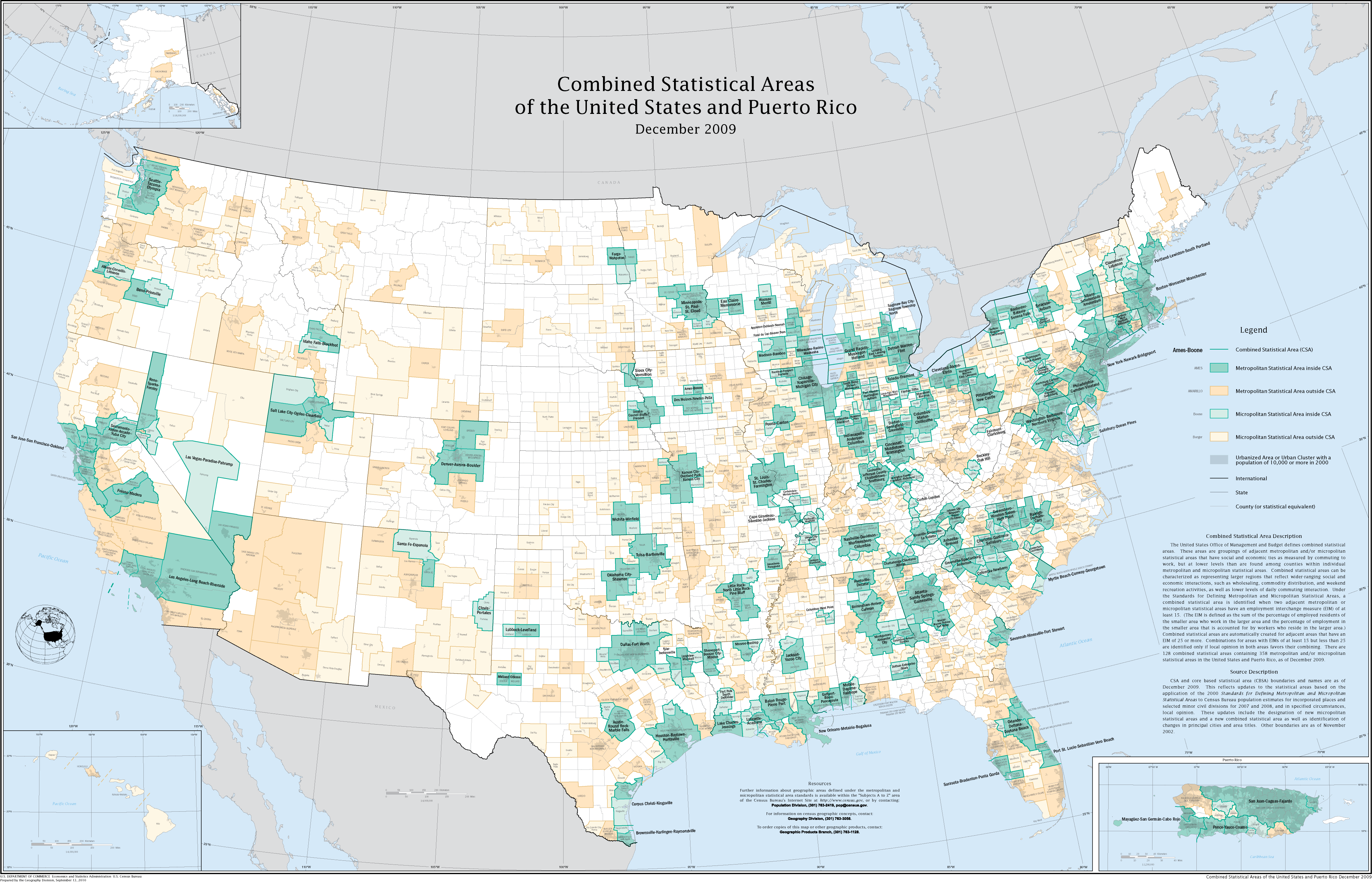
Data: Combined and Core-based Statistical Areas
The U.S. Census Bureau groups counties into combined statistical areas (CSAs)
and core-based statistical areas (CBSAs) primarily based on county population
and economic activity. NOTE: Not all counties are members of a CSA or CBSA. For
a detailed description, Wikipedia has excellent discussions of both areas:
CSAs and
CBSAs. Also, the
following map from Wikipedia is excellent to visualize the areas:
data(combined_areas, package="noncensus")
combined_areas
data(corebased_areas, package="noncensus")
corebased_areas
Data: County Population Data by Age
A dataset containing the population totals and percentages for each US county
by age of inhabitant. The variables are as follows:
\itemize{
\item fips. FIPS code for the county
\item age_group. Age groups are in 5 year intervals
\item population. Count of people in that county in that age group
\item percent. Percent of that county's total population in that age group
}
data(population_age, package="noncensus")
population_age
Data: Income, Poverty, and Health Insurance in the U.S.
A dataset containing the U.S. Census QuickFacts table of frequently requested
data items from various Census Bureau programs, including population, age
groups, race, and miscellaneous household and economic information by county.
The row with FIPS code of 0 provides the demographic data for the entire U.S.
data(quick_facts, package="noncensus")
quick_facts
Data: Polygons of Each U.S. County's Geographical Shape
Data containing the vertices to describe each U.S. county's geographical
shape as a polygon. Vertices are given in terms of latitude and
longitude. The order in which the vertices should be drawn are also given by
order.
NOTE: A small number of counties have multiple groups. Typically, these
counties are separated into multiple polygons by, say, a body of water.
Example: Galveston, Texas (FIPS == 48167).
data(county_polygons, package="noncensus")
county_polygons
ramhiser/noncensus documentation built on May 26, 2019, 10:11 p.m.
R Package Documentation
Browse R Packages
We want your feedback!
Note that we can't provide technical support on individual packages. You should contact the package authors for that.
library(noncensus) library(dplyr) knitr::opts_chunk$set( comment="#>", error=FALSE, tidy=FALSE) options(dplyr.print_min = 4L, dplyr.print_max = 8L)
U.S. Census Region and Demographic Data
The goal of this document is to provide an introduction to the collection of
various data sets within noncensus provided by the U.S. Census Bureau. We
describe each data set briefly and refer the reader to each data set's help
documentation for further details. Each data set is stored as a tbl_df object
from the dplyr package rather than a standard data frame. Also, within the
inst/data_scripts/ folder, we have also included scripts to download, process,
and load the original data from their sources.
Data: U.S. States and Territories
A dataset containing demographic information and the census regions of each U.S. state as defined by the U.S. Census Bureau. Also included are the U.S. territories, such as Puerto Rico and Guam.
In addition to the state information, each state is allocated to one of four regions:
- Midwest
- Northeast
- South
- West
Within each region, states are further partitioned into divisions. For more details about census regions and divisions, see this Wikipedia article. Much of the state data was extracted from the U.S. Census Bureau.
data(states, package="noncensus") states
Data: U.S. Counties and County-Equivalent Entities
This data set contains state and county FIPS codes for U.S. counties and county-equivalent entities (CEE), which includes non-state locations, such as Puerto Rico (PR) and Guam (GU). Each U.S. county is uniquely identified by its FIPS code.
The U.S. Census Bureau groups counties into Combined Statistical Area (CSAs) and Core-based Statistical Area (CBSAs) primarily based on county population and economic activity. We provide further details about these areas in another section below. NOTE: Not all counties are members of a CSA or CBSA.
For further details about FIPS codes and classes, see the Census Bureau's website.
data(counties, package="noncensus") counties
Data: U.S. Cities by Zip Code
This data set considers each zip code throughout the U.S. and provides additional information, including the city and state, latitude and longitude, and the FIPS code for the corresponding county.
The ZIP code data was obtained from the zipcode R
package. The county
FIPS codes were obtained by querying the FIPS code from each zip's latitude and
longitude via the FCC's Census Block Conversions
API. The FIPS
codes are useful for mapping ZIP codes and cities to counties in the counties
data set.
Fun fact: ZIP is an acronym for Zone Improvement Plan.
data(zip_codes, package="noncensus") zip_codes
Data: Combined and Core-based Statistical Areas
The U.S. Census Bureau groups counties into combined statistical areas (CSAs) and core-based statistical areas (CBSAs) primarily based on county population and economic activity. NOTE: Not all counties are members of a CSA or CBSA. For a detailed description, Wikipedia has excellent discussions of both areas: CSAs and CBSAs. Also, the following map from Wikipedia is excellent to visualize the areas:
data(combined_areas, package="noncensus") combined_areas
data(corebased_areas, package="noncensus") corebased_areas
Data: County Population Data by Age
A dataset containing the population totals and percentages for each US county by age of inhabitant. The variables are as follows:
\itemize{
\item fips. FIPS code for the county
\item age_group. Age groups are in 5 year intervals
\item population. Count of people in that county in that age group
\item percent. Percent of that county's total population in that age group
}
data(population_age, package="noncensus") population_age
Data: Income, Poverty, and Health Insurance in the U.S.
A dataset containing the U.S. Census QuickFacts table of frequently requested data items from various Census Bureau programs, including population, age groups, race, and miscellaneous household and economic information by county.
The row with FIPS code of 0 provides the demographic data for the entire U.S.
data(quick_facts, package="noncensus") quick_facts
Data: Polygons of Each U.S. County's Geographical Shape
Data containing the vertices to describe each U.S. county's geographical
shape as a polygon. Vertices are given in terms of latitude and
longitude. The order in which the vertices should be drawn are also given by
order.
NOTE: A small number of counties have multiple groups. Typically, these counties are separated into multiple polygons by, say, a body of water. Example: Galveston, Texas (FIPS == 48167).
data(county_polygons, package="noncensus") county_polygons
R Package Documentation
Browse R Packages
We want your feedback!
Note that we can't provide technical support on individual packages. You should contact the package authors for that.
Embedding an R snippet on your website
Add the following code to your website.
For more information on customizing the embed code, read Embedding Snippets.